HIKING THE TONGARIRO ALPINE CROSSING IN NEW ZEALAND: COMPLETE GUIDE
In order to give this hike an appropriate introduction, I have to tell you first about the weather conditions that we endured during this trek. We went to New Zealand in April, which is supposed to be their fall. This April, however, was unusually cold, windy, and rainy, which made for a lot of cancelled excursions. The day that we had set aside to do this trek was no different.
While checking into our hotel, which I swear was haunted (another story..), we noticed a sign at the check-in counter that described the conditions for the following day for the Tongariro Trek. The sign stated a -3˚C windchill with up to 70 mph winds. I know! Crazy, right??
Despite these horrible weather conditions, we layered up and decided to attempt this hike. We headed out from the hotel early that morning with our guide to the Mangatepopo car park.
TIPS BEFORE YOU START:
Schedule a shuttle to/from your hotel - Parking at the Mangatepopo car park is limited to 4 hours for people that are doing shorter walks. If you are completing the entire trek, then you need to schedule a shuttle.
Check the weather. Check the weather. Check the weather!
Dress in layers.
FACTS ABOUT THE HIKE:
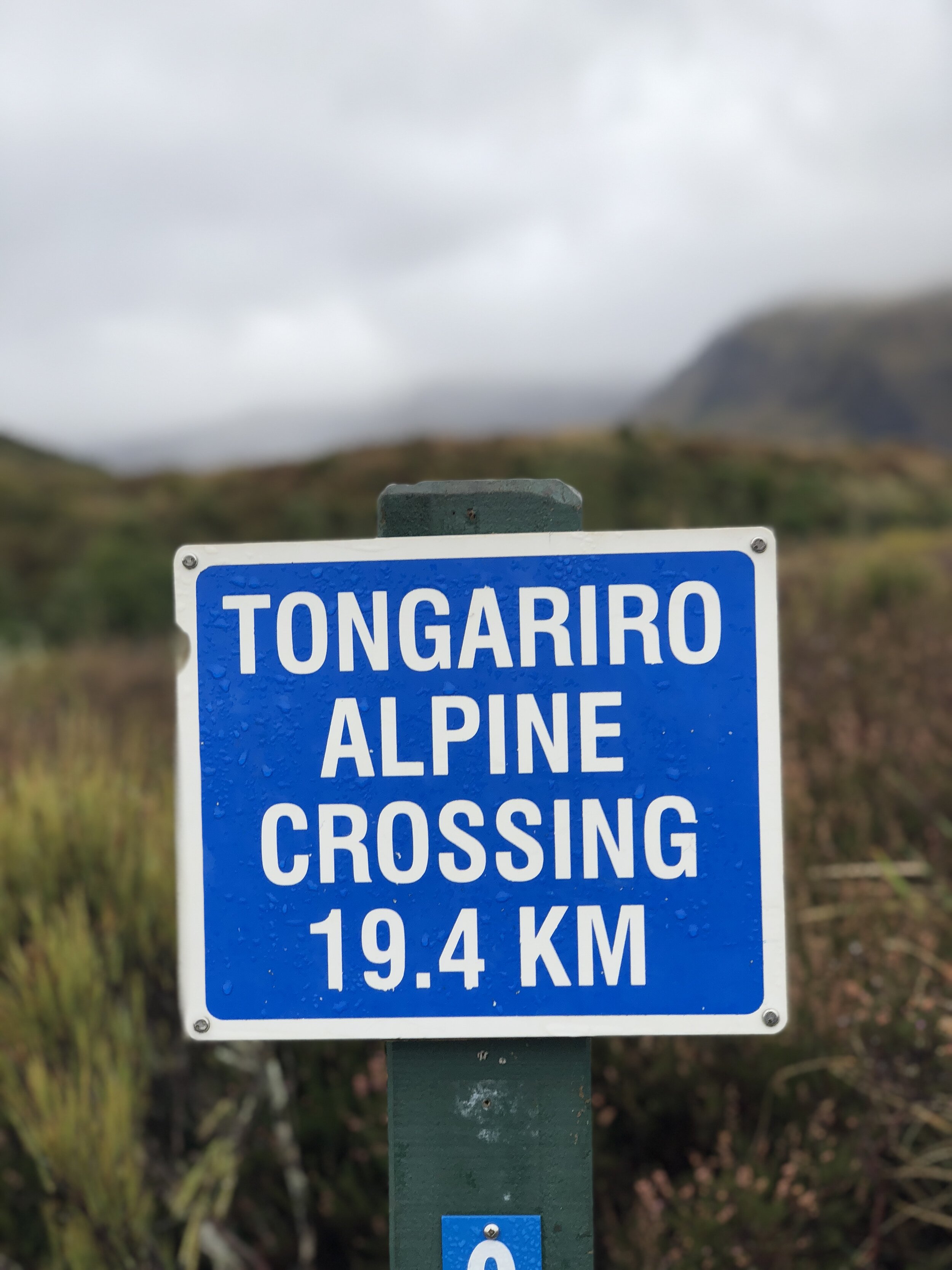
Distance: 19.4 km (12 miles) point-to-point
Elevation Gain: 765 meters elevation gain and 1125 meters elevation loss if you hike from Mangatepopo car park to Ketetahi car park
Difficulty: Strenuous
Length of Time: 6 to 8 hours
Location: Tongariro National Park, North Island of New Zealand

ESSENTIALS FOR THE TREK:
Tongariro National Park can be subject to unpredictable weather, and conditions can change quickly. It is important that all walkers carry the essentials for their journey across.
Take:
Food and plenty of fluid, especially in the summer months. If you are planning on completing any of the summit tracks, ensure you have additional water supplies.
Waterproof and wind-proof raincoat and trousers
Strong, sturdy boots (you will be trekking over uneven volcanic terrain)
Warm clothing layers: woolen or polypropylene thermals and fleece
Hat and gloves
Hot Hands
Sunscreen and sunglasses
First Aid Kit
Map
Cellphone
Due to the rugged and alpine environment, the weather in the car park at the beginning of the track can differ greatly from conditions 1000 meters higher further up the track. Be prepared to change your plans and turn back especially when visibility is poor or strong winds prevail. [C/O Tongariro Crossing]

Mangatepopo Car Park to Soda Springs (~1-1.5 hours)
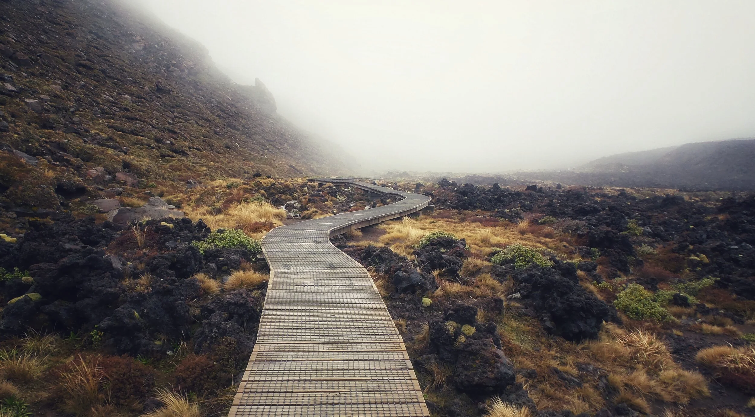
When you leave the carpark, you will start off walking through the scrubby grassland, toward the Mangatepopo Valley. The trail is well-maintained and an easy walk starting off as boardwalks have been build to help protect the fragile environment. Views of Mount Ruapehu will be to the left, and as you round the corner, ominously in the distance, Mount Ngauruhoe comes into view.


Like so many other locations in New Zealand, Tongariro National Park was used during filming of Lord of the Rings. You might remember it as Mordor, where, during the entire trilogy, Frodo and Sam try to get to Mount Doom, aka Mount Ngauruhoe, so they can destroy the infamous ring. Unfortunately, as I stated earlier, the weather was terrible so Mount Doom was not visible during our trek. The next day, however, the weather cleared and there was a beautiful view of Mount Doom in the distance.

Soda Springs to South Crater (~1 hour)
This area of the trek is known as the “Devil’s Staircase” because it is super steep. If you have a clear day, then I’ve heard that view is beautiful. Even on an overcast day, the view looking out over the valley is still breathtaking.
This is a huge contrast from the leisurely boardwalk walk at the start of the trek. By the time you reach the top, you will be breathless!


Remember those layers that I recommended..yes this hike was done on the same day. I think I had enough clothes to change my full outfit like 3 times haha!


SOUTH CRATER TO RED CRATER (~1 HOUR)
After climbing up Devil’s Staircase, you will continue along a long flat trail that looks like a lunar landscape that you would find on Mars. I don’t have any photos from here as this is where the weather took a turn for the worse.
These are the photos from the official Tongariro Alpine Crossing site. As you can see, the area is gorgeous on a clear day, even in the winter!


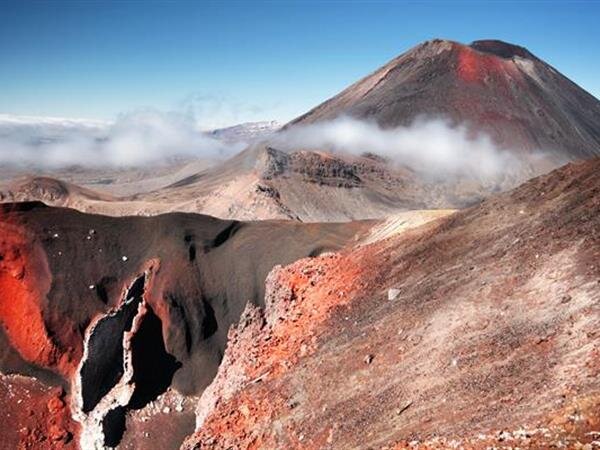
At the top of south crater, there are the emerald pools.

RED CRATER TO BLUE LAKE (~30 MINUTES)
Once you reach red crater, you are on an exposed ridge. Once we reached this point, it was -3 degrees C with winds up to 45 mph. It was literally insane. Due to the loose rock and sand, we were crawling at one point up this ridge with the volcanic crater to our right and a dropoff to our left. We could not see more than 2 ft in front of us. It was a very scary situation.

BLUE LAKE TO KETETAHI SHELTER (~1 HOUR)


KETETAHI SHELTER TO KETETAHI CAR PARK (~2 HOURS)


PACKING GUIDE FOR THIS TREK:
Disclaimer: This list contains Affiliate Links for products I’m currently using. By using these links you won’t pay any additional fees but support me to keep this site running!
The packing list below are the necessities for a trek on the Tongariro Alpine Crossing. The weather is unpredictable and can change quickly, so I recommend to pack in layers to be most comfortable.
CLOTHING
Thermals (Base layer) - I like Thermotech or Hot Chilly’s
Waterproof Jacket and Pants (I like this Northface Gor-Tex but Frogtoggs are the cheapest, most economical option.)
Mid-layers
Outer-layers
Hiking Pants (I like these Columbia ones or these Eddie Bauer ones)
Hiking Socks (My absolute favorite! They are double-layered to prevent blisters.)
Hiking shoes (Great resource for hiking boot reviews here)
Timberland Women’s Mt Maddsen Mid Leather Waterproof Hiking Boot
Merrell Moab 2 WP Low Hiking Shoes - These are my personal favorites, although, they are very heavy.
Refillable Water Bottle - This one is nice because it has a clip to clip to your bag and also it compresses so packs down easily.
Coola Sunscreen - My fav!
Extra SD Cards